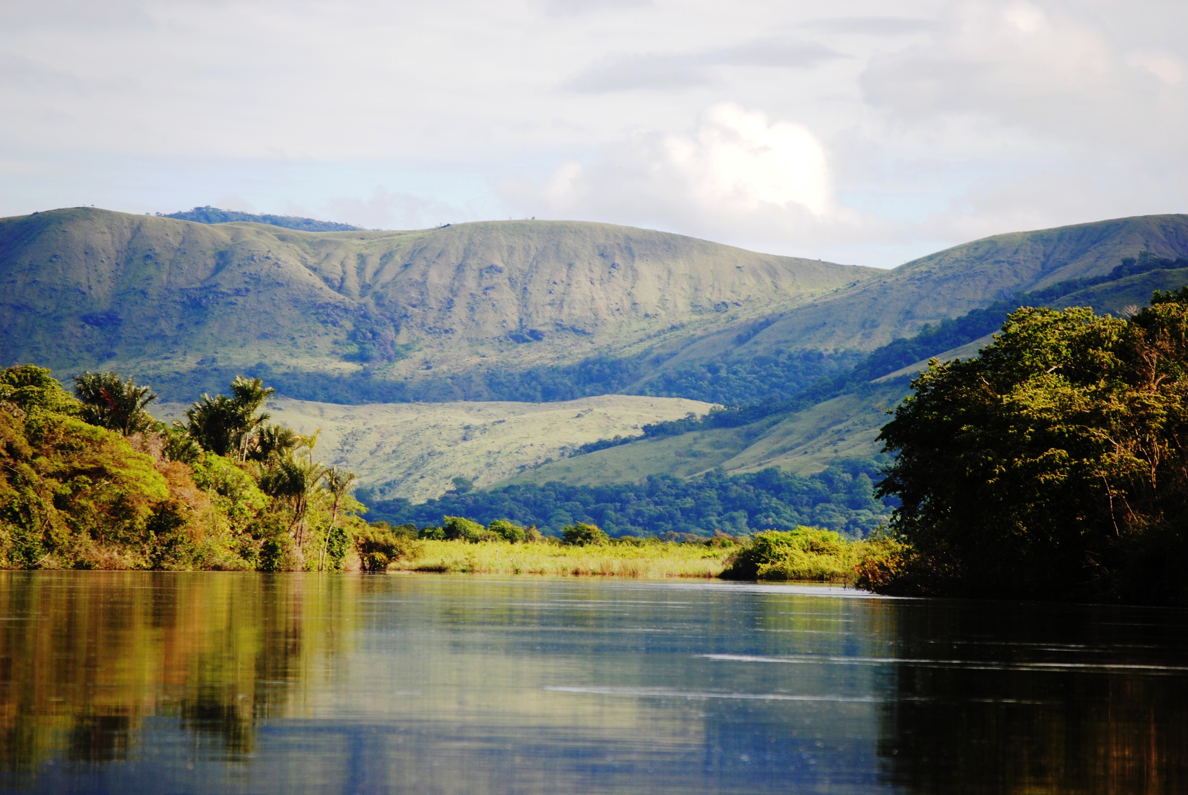
THE IWOKRAMA FOREST AND NORTH RUPUNUNI WETLANDS
Rock View is situated in one of South America’s most biodiverse and geographically varied regions.
Rock View Lodge employs several well-trained naturalist guides who are prepared to meet the demanding needs of professional nature scholars, media crews, and enthusiastic guests of all stripes. Be sure to look at the bird, animal, and plant lists we’ve been working on. You’ll also find on those pages links to external sources of authoritative information about the natural features of Guyana.
Biodiversity in this Natural Setting
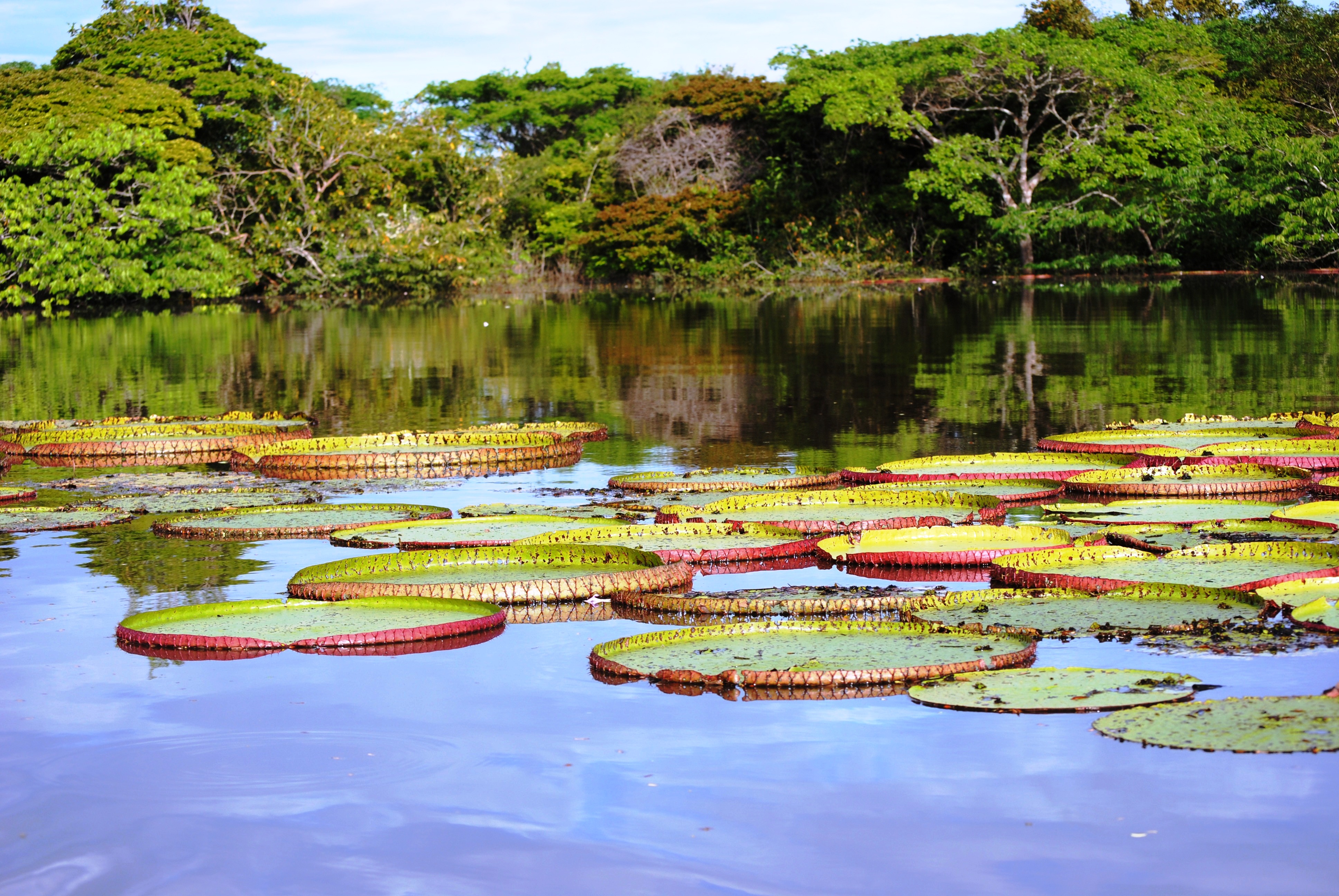 The North Rupununi Wetlands includes “a representative, rare, or unique example of a natural or near-natural wetland type.” The area includes a site of biotic exchange between the Essequibo (Guyana Shield) and the Rio Branco (Amazonian) drainages. In this regard, the Rupununi Wetlands are similar to the Marais de Kaw site of Guyane but is otherwise unique. The flooded savannas on the Rupununi River and oxbow lake systems along the Essequibo and Rupununi Rivers are also rare wetland types in Guyana. The Iwokrama Forest and North Rupununi Wetlands also the ancestral domain of the Makushi people and so are unique in this regard.
The Iwokrama Forest and North Rupununi Wetlands support several “vulnerable, endangered, or critically endangered species” including the Giant Water Lily (Victoria amazonica), Black Caiman (Melanosuchus niger), Arapaima (Arapaima gigas) and the Amazonian River Turtle (Podocnemis expansa) which have restricted distributions along the Rupununi and Essequibo Rivers. In addition, The North Rupununi Wetlands and Iwokrama Forest support numerous endangered and threatened species including species listed on appendix I of the Convention on International Trade in Endangered Species and species listed on the IUCN red list or that are considered to be locally threatened (Johns 2002). These species include Greenheart (Chlorocardium rodiei), Virola surinamensis, Rosewood (Aniba rosaeodara), Guyana Manicole palm (Syagrus stratincola), Couratari calycina, Eschweilera fanshawei, Eschweilera potaroensis, Graffenrieda caudata, Pouteria penicillata, Cock-of-the Rock (Rupicola rupicola), Seed finches (Oryzoborus crassirostris and O. angolensis), Bonneted bat (Eumops maurus), Bearded tachuri (Polystictus pectoralis), Hoary spintetail (Synallaxis kollari), Harpy eagle (Harpia harpyja), Guianan crested eagle (Morphnus guianensis), Blue-cheeked Amazon parrot (Amazona dufresniana), Spix’s and Marail guan (Penelope jacquacu and Penelope marail), Black curassow (Crax alector), Crestless Curassow (Mitu tomentosa), Bush dog (Speothos venaticus), Jaguar (Panthera onca), Tapir (Tapirus terrestris), Cotingidae: all species of genera Cotinga, Xipholena, Iodopleura, Querula, Pyroderus, 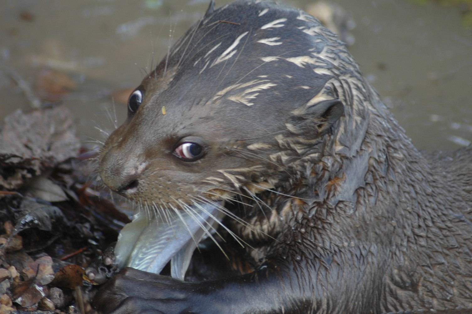 Perissocephalus, Gymnoderus, Procnias, Phoenicircus, Black spider monkey (Ateles paniscus), Giant Otter (Pteroneura brasiliensis), Neotropical Otter (Lontra longicaudis), Beddard’s Olingo (Bassaricyon beddardi), Giant Armadillo (Priodontes maximus) and the Tapir (Tapirus terrestris).
The Iwokrama Forest and North Rupununi Wetlands also “support populations of plant and/or animal species important for maintaining biological diversity” including approximately 200 mammal species, 500 bird species, over 150 species of amphibians and reptiles and over 400 species of fish (Donnelly et al. 2000; Engstrom et al. 2000; Watkins 1999). A description of the Iwokrama Forest flora is available and includes more than 1500 species of plants (Clarke 2001). The area therefore represents a substantial portion of the total biodiversity in Guyana and being located in the centre of the Guayana Shield is fundamental to the biodiversity of the region.
The Iwokrama Forest and North Rupununi Wetlands also “support plant and/or animal species at a critical stage in their life cycles, or provides refuge during adverse conditions.” The Rupununi River overflows its banks in the rainy season to flood large areas of savanna grasslands. These areas, in addition to small mountain streams, palm forest swamps, and oxbow lakes are important spawning areas for fish from the Essequibo. In addition, the flooded savannas and forests and the lake systems provide support and refuge for many young fish and the predators that feed on them.
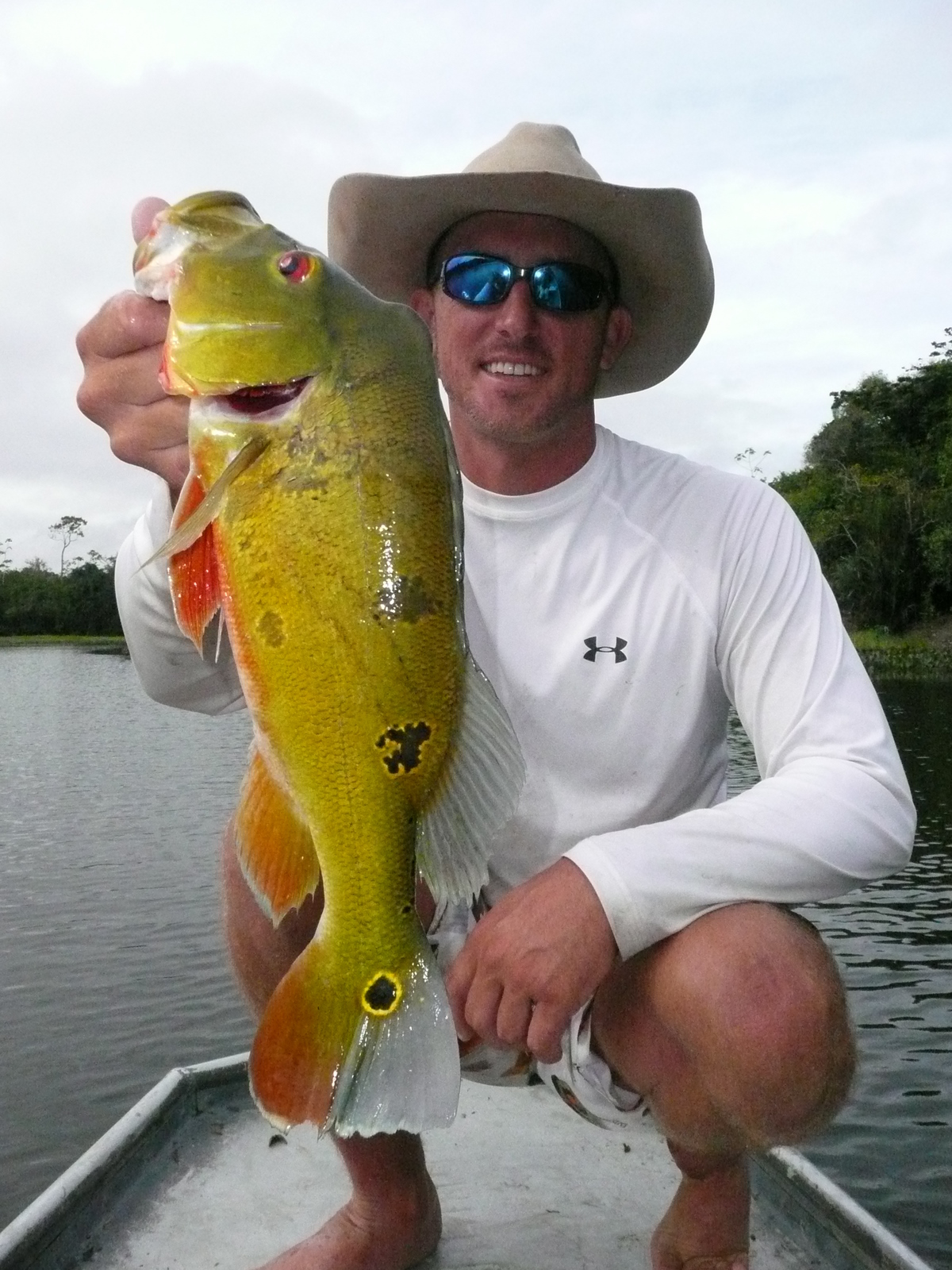 The Iwokrama Forest and North Rupununi Wetlands “support a significant proportion of indigenous fish subspecies, species or families, life-history stages, species interactions and/or populations.” Over four hundred species from twenty nine families and eleven orders have been recorded from the Siparuni, Burro-Burro and Essequibo Rivers. Estimates of species richness suggest that there may be over 500 species in the areas sampled and when survey results are available from the Rupununi wetlands, this number may be much higher. An outstanding feature of the fish communities in the rivers near and in the Iwokrama Forest is the continued presence of healthy populations of many species that have been overharvested in many other areas. These species include the large Pimelodid catfishes such as Phractocephalus hemiliopterus, Brachyplatystoma spp., Paulicea luetkeni, Pseudoplatystoma spp., the Osteoglossids Arapaima gigas and Osteoglossum bichirrosum, Characids such as Myleus pacu, the Cichlid Cichla ocellaris, and the Sciaenid Plagioscion squamosissimus. The implication is that the fish communities of the Iwokrama Forest represent one of the few remaining unaltered fish communities in the Neotropics.
Finally, the Iwokrama Forest and North Rupununi Wetlands are the basis for an “important source of food for fishes, spawning ground, nursery and/or migration path on which fish stocks, either within the wetland or elsewhere.” The Rupununi River and surrounding periodically flooded savannas are major spawning and nursery areas for fish from the Essequibo drainage. The flooded savannahs also provide a major food source for fish during rainy season dispersals and are the basis for a food chain that culminates with jaguars, giant river otters, arapaima and the massive pimelodid catfish.
Physical and Hydrological Features
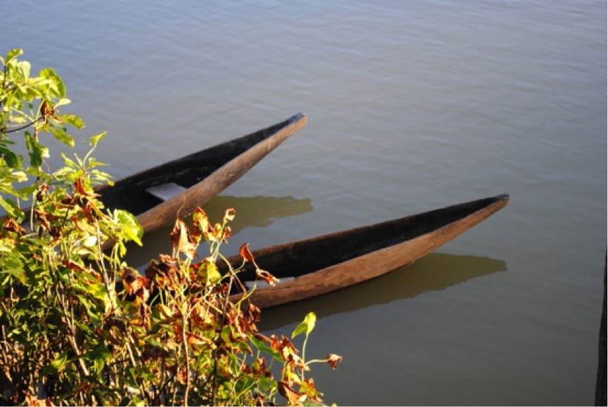 The Iwokrama Forest and North Rupununi Wetlands are situated on an old and complex mix of sedimentary, metamorphic and volcanic geological formations (Gibbs & Barron 1993). Soils in the area are nutrient poor weathered sands.
Water levels fluctuate substantially (4-10 metres) and flooding is seasonal – usually May to September. The area includes several catchments, but upstream Rupununi, Essequibo, Siparuni and Burro-Burro are outside of the proposed Ramsar area. Annual rainfall varies from 3,000 mm in the north to 1,400 mm in the south. The differences in rainfall are largely driven by two rainy seasons in the northern part of the Iwokrama Forest (driven by the Intertropical Convergent Zone) and only one rainy season (continental) in the Rupununi Wetlands. Between 50 and 70% of the total annual rainfall occurs between May and August and the intensity of rainfall during this period can be more than 100 mm in a day. The driest months of the year are October and March with an intervening increase in rainfall from November to February in the north.
The wetlands include the Rupununi, Rewa, Essequibo, Burro-Burro, and Siparuni Rivers and associated oxbow lakes and periodically flooded savannas and forests.
Ecological Features
The Iwokrama Forest and North Rupununi Wetlands includes plant communities associated with fast flowing creeks, rapids, river islands, river levees, river margins, flood plains, swamps, and lakes (Clarke et al. 2001).
The savannah areas include flooded grasslands that are important spawning areas. Several species have been surveyed in the area including counts of over 50,000 Black Caiman and a reduced population of adult Arapaima (1105) that is slowly recovering. Giant Otters are being surveyed and the results of this work should be available in 2003.
Noteworthy Flora
The Iwokrama Forest and North Rupununi Wetlands support several “vulnerable, endangered, or critically endangered species” including the giant water lily (Victoria amazonica), which has a restricted distributions along the Rupununi and Essequibo Rivers. In addition, The North Rupununi wetlands and Iwokrama forest support numerous endangered and threatened species including greenheart (Chlorocardium rodiei), swamp dalli (Virola surinamensis), rosewood (Aniba rosaeodara), Eschweilera fanshawei, Eschweilera potaroensis, and Pouteria penicillata.
Noteworthy Fauna
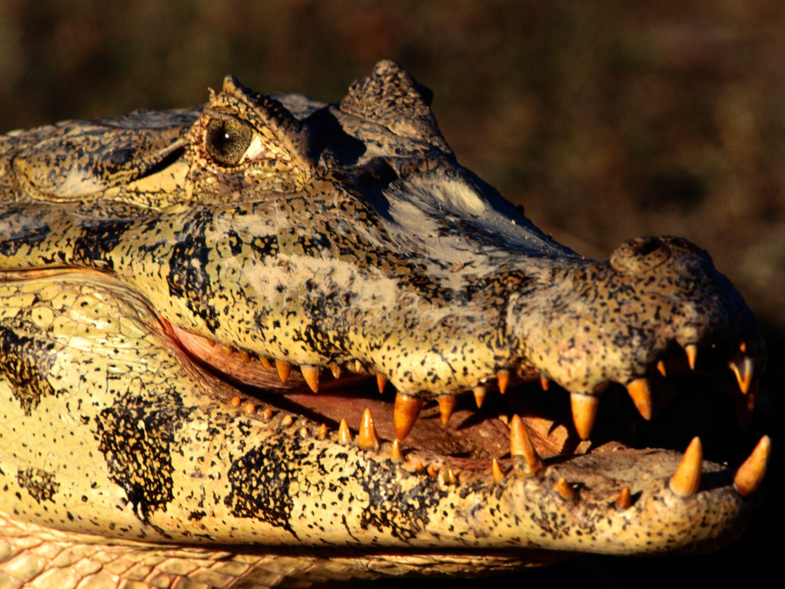 The Iwokrama forest and North Rupununi wetlands support several “vulnerable, endangered, or critically endangered species” including black caiman (Melanosuchus niger), arapaima (Arapaima gigas) and the amazonian river turtle (Podocnemis expansa) which have restricted distributions along the Rupununi and Essequibo Rivers. In addition, The North Rupununi wetlands and Iwokrama forest support numerous endangered and threatened species including species listed on appendix I of the Convention on International Trade in Endangered Species and species listed on the IUCN red list or that are considered to be locally threatened. These species include Guianan cock-of-the rock (Rupicola rupicola), seed finches (Oryzoborus crassirostris and O. angolensis), bonneted bat (Eumops maurus), bearded tachuri (Polystictus pectoralis), hoary spintetail (Synallaxis kollari), harpy eagle (Harpia harpyja), Guianan crested eagle (Morphnus guianensis), blue-cheeked Amazon parrot (Amazona dufresniana), spix’s and marail guan (Penelope jacquacu and Penelope marail), black curassow (Crax alector), crestless curassow (Mitu tomentosa), bush dog (Speothos venaticus), jaguar (Panthera onca), tapir (Tapirus terrestris), cotingidae: all species of genera Cotinga, Xipholena, Iodopleura, Querula, Pyroderus, Perissocephalus, Gymnoderus, Procnias, Phoenicircus, black spider monkey (Ateles paniscus), giant otter (Pteroneura brasiliensis), neotropical otter (Lontra longicaudis), beddard’s olingo (Bassaricyon beddardi), giant armadillo (Priodontes maximus) and the tapir (Tapirus terrestris)
Social and Cultural Values
Tourism is developing in Guyana and the Iwokrama Forest and North Rupununi Wetlands is an important draw for visitors to Guyana. There are four lodges functioning in the areas including Karanambu Ranch, Rockview Lodge, Surama Village, and the Iwokrama River Lodge. Tourism is constrained by high travel costs and low international awareness about the area.
Iwokrama has developed a functioning field station within the Iwokrama forest that accommodates researchers and an internationally recognized training programme. The focus of research in the Iwokrama forest is on the development of approaches to sustainable forest management. In addition, the Bina Hill Institute and the North Rupununi District Development Board have developed, in association with Iwokrama, an active programme of research in traditional knowledge, resource use and mapping, and stock assessments for target species.
Agricultural production in the area is minimal with a focus on subsistence production of cassava, fruits and vegetables. There is some production of peanuts and potentially cashew nuts and some ranching. Ranching, however, has declined substantially since the cattle ranching hey day prior to the 1960s. Fisheries production from the area has been traditionally for the use of local communities; however, commercial production for Georgetown and Brazil has increased as access has increased through the road that was developed in the early 1990s. Fish remain as the major source of protein in the wetlands. As such, fishing is an extremely important subsistence activity. Historical (1960-1970) rates of exploitation of Arapaima (Arapaima gigas) and River Turtles (Podocnemis expansa) were not sustainable, but commercial fishing of these resources has been reduced in the last five years. Unfortunately, fisheries resources are open access; however, a new Fisheries Act offers the opportunity for developing management plans for the fisheries in the are to deal with growing pressures on the fisheries from Lethem, Brazil and Georgetown fishermen; as well as an increasing focus on local income generation from the fisheries for Apoteri, Rewa, Fairview and Crash Water. Sustainable fisheries management would be entirely consistent with the development of the area as a Ramsar site.
In addition, the area represents the ancestral homelands of the Makushi people. The following is an excerpt from the Strategic Plan of the North Rupununi District Development Board (North Rupununi District Development Board 2002):
“The Guyanese Makushi people live in the area bordered by the Takatu and Siparuni Rivers down to the Essequibo River, up the Essequibo River across to the Rewa and Kwitaro River along the Kanuku Mountains and then across to the Pakaraima Mountains. These lands were used by the Makushi people of the Peyakati, and are now known as the North Rupununi. This area was protected by the Makushis of the North Rupununi with the support of the Parauyan Makushi from the Raposa do Sol in Brazil. The main reason for the protection of the area was that Curari-Iwokramî and Kata ye’ (Greenheart seeds) were collected in the area.
Since establishment of the national boundaries of Guyana and Brazil, the Makushi peoples of Brazil and Guyana were separated and much of the knowledge about the relations between these two peoples was lost. However, the North Rupununi Makushi people still have the sense of, and maintain the practice, of ownership of the North Rupununi. During the 1960s, the Amerindian Land Commission recognized the North Rupununi lands and recommended that the Makushi be given title to the North Rupununi as described in the previous paragraph. In the mid 1970s, the revised Amerindian Act scheduled Toka, Massara, Yakarinta villages and Annai district in the Act as villages and a district with title to their lands. However, the allocated lands did not include the original complete area of the North Rupununi, but rather substantially smaller areas. In particular, the area where Curari was found (the Iwokrama Forest) was excised from these lands; this further disconnected the Makushi of the North Rupununi from their lands. The 1991 Amerindian land titles issued by the then President Desmond Hoyte proscribed the Amerindian lands of each of the four North Rupununi communities into smaller areas and excluded the traditional hunting, fishing and natural resource use areas of the Makushi people.”
Land Tenure and Ownership of the Site
The North Rupununi Wetlands and Iwokrama Forest have mixed land tenure systems. The whole area is part of a 1966 Makushi land claim and three areas have been allocated to Amerindians under the Amerindian Act including Annai District, Toka, Massara, and Yakarinta. The remainder of the land is considered State Land and State Forest, with the Government allocating management rights for the Iwokrama Forest to the Iwokrama International Centre for Rain Forest Conservation and Development.
Current Land Use
As described above, current land use is focused on subsistence agriculture, sustainable forest management, subsistence fishing, and small scale commercial agriculture, ranching and fishing. There is some tourism, including several developing community based tourism businesses. The total population in the area is approximately 3,900. Some mining occurs in the catchment including gold and diamond mining in the Pakaraimas near the Siparuni River which feeds into the Essequibo, and in South Rupununi. Flooded wetland areas are used in dry season for small scale agriculture.
The area is important locally as a source of independent food supplies for subsistence, which in turn is reflected in local cultural festivals, local institutions, interest in resource management and a series of traditional management institutions including taboos and traditional management systems.
The wetland areas are also currently used for subsistence farming, fishing and hunting and for some commercial exploitation of fish – aquarium fish and Arapaima. There is some small scale peanut farming in the Rupununi and plans for sustainable timber extraction from the Iwokrama forest and surrounding forested areas. The Wilderness Preserve areas of the Iwokrama Forest and the Conservation International Conservation Concession have been allocated for conservation.
Adverse Factors
The development of the Lethem-Georgetown road perhaps poses the greatest threat to the integrity of the Iwokrama Forest and North Rupununi Wetlands site. Improvements to the road will increase access to forest resources in the area, and in the absence of effective management systems, the consequences could be dire. The development of the road to date has increased the rate at which resources are being removed from the area, in particular fish and timber resources. The wetlands also overlie some petroleum reserves, the exploitation of these reserves without environmental controls could also be a threat to the integrity of the wetlands ecosystem. Plans for future agricultural development will also need to consider the potential negative impacts of pesticides and herbicides on these wetland areas.
Conservation measures taken
The Iwokrama Forest (3,600 Ha) was established in 1996 and is presently managed by the Iwokrama International Centre as an Integrated Conservation and Development Project. This project has had a major impact on the area that includes supporting the strengthening of community institutions in the North Rupununi. The Iwokrama Forest is a protected area recognized under the Iwokrama Act (1996). The management plan for the Iwokrama Forest is being developed at the moment and is due to be finished in early 2003. In addition, Conservation International and the Guyana Forestry Commission established a 40,000 Ha conservation concession in 2001.
Conservation plans
A strategic plan has been developed for the management of the North Rupununi Wetlands by the NRDDB. A management plan for Arapaima has been developed and will hopefully be expanded into a general fisheries management plan in the future. The NRDDB has been instrumental in the development of relations with the Fisheries Department of the Ministry of Fisheries, Crops and Livestock (see early description of this in (Forte et al. 1999)). Present activities focus on developing management plans for Arapaima and Aquarium Fish and examining the development of fish farms in the area. The Arapaima management plan will be the first in a series of plans for the management of natural resources in the North Rupununi, and is the first example, that we know of, of community based inland fisheries management in Guyana. As part of the management of fisheries in the area, Fisheries Committees are being developed in each community to be managed by an Executive Fisheries Committee at the NRDDB. The NRDDB has also recently purchased an aluminium boat and engine for fisheries management activities, outreach, and transportation to and from meetings. Fisheries projects involve working with Fisheries Department and EPA, Iwokrama, Conservation, Food and Health Organization, Projeto Piaba, Mamiraua Institute, New England Aquarium and the Natural Resources Institute.
Conservation International, the Rockview Lodge, and the Karanambu Trust and Ranch are also important stakeholders in the future management of the area.
Current scientific and research facilities
There is a field station in the Iwokrama Forest at Kurupukari and a research and development institute at Bina Hill in Annai. Several research projects are presently underway including studies of Arapaima, Black Caiman, Tapirs, traditional knowledge systems, and fish diversity.
Conservation education
There is a strong conservation education programme in the Rupununi through the development of wildlife clubs and educational visits from Iwokrama and NRDDB staff to communities. The Bina Hill Institute is developing environmental curricula and beginning to modify the School Yard Ecology approach to environmental education in the area. Schools from the area have visited the Iwokrama field station and the Annai secondary school is situated next door to the Bina Hill Institute. Educational books have been prepared on community based wildlife management (Forte et al. 1999) and bilingual booklets on birds and fish of the Rupununi (Makushi Research Unit & Forte 1999, 2000).
Recreation and tourism
Tourism is slowly developing in the North Rupununi and Iwokrama Forest. The wetlands are used extensively for visits as part of this. There are eight functioning lodges in the area – Karanambu Ranch, Rock View Lodge, Surama Eco-Lodge, Iwokrama Field Station, Caiman House, Atta Rainforest Lodge at the Iwokrama Canopy Walkway, Maipaima Eco-Lodge, and Rewa Eco-Lodge.
This information is adapted from a series of publications and internal reports prepared by Iwokrama and NRDDB staff, consultants, and others to document the biological diversity and management systems of the North Rupununi Wetlands and the Iwokrama Forest
